Extent of glaciers in the federal geoportal
01.05.2022 | GLAMOS
Glacier Monitoring in Switzerland (GLAMOS) aims to document glacier changes in Switzerland in the long term. Data are collected systematically, not only on development of surface area and volume, but also on snow accumulation, melting of ice, glacier flow and ice temperatures. This information is important for understanding the interaction between glaciers and climate. It is used to estimate water resources, natural hazards and future rise in sea level.
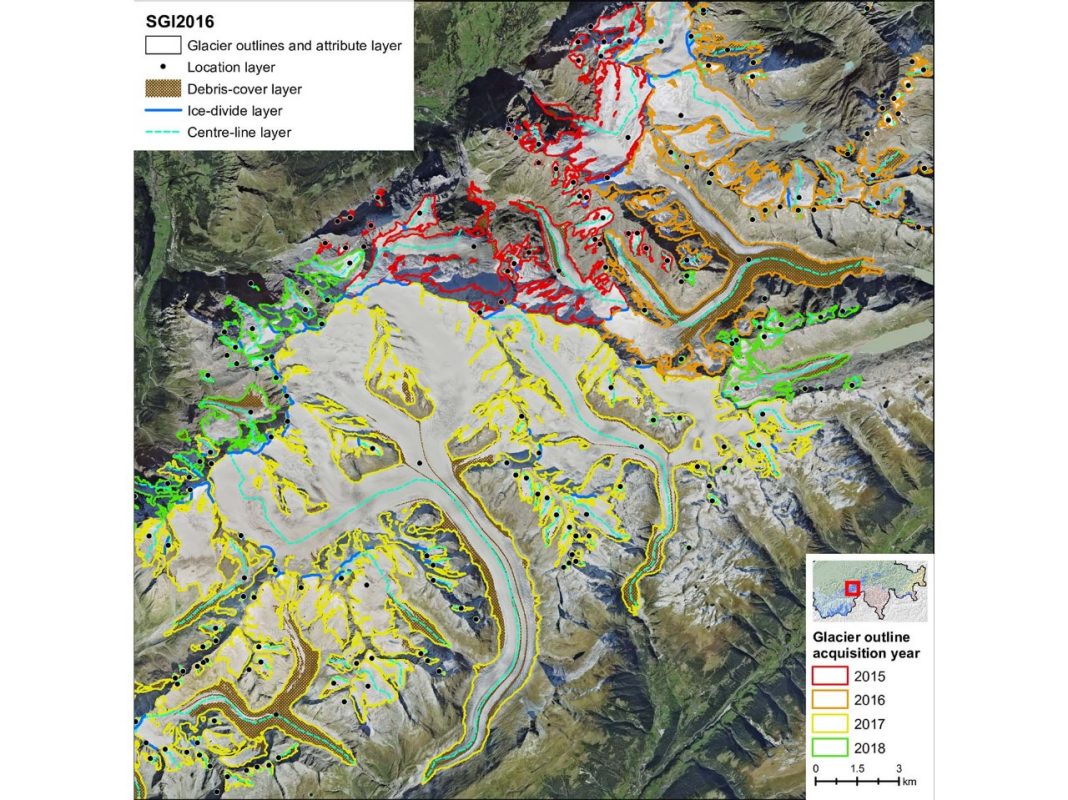
Glacier inventories include perimeters, surface areas and other measurement parameters for all glaciers at a given time in a specific area. For the Swiss Alps, complete inventories are available for the years 1850, 1973, 2010 and 2016.
While the previous surveys were based on different methodological approaches and data such as historical maps, aerial photographs or satellite images, thanks to an intensified cooperation between GLAMOS and swisstopo, sustainable synergies could be used to produce the latest inventory for 2016. Thereby a previously not attained level of detail has been achieved and an update at regular intervals has become possible. There are currently around 1400 glaciers in the Swiss Alps, covering an area of 961 ± 22 km². For the first time, it was also possible to determine the debris-covered area of the glacier surface, which accounts for 11% or 104 km² and is likely to increase in the course of the ongoing glacier retreat.